'%20stroke='none'%3e%3cpath%20d='M%20761%2039%20L%20760%2062%20L%20912%20216%20L%201003%20329%20L%201071%20463%20L%201112%20603%20L%201132%20608%20L%201149%20582%20L%201165%20516%20L%201163%20403%20L%201145%20330%20L%201088%20216%20L%201017%20132%20L%20918%2062%20L%20821%2034%20Z'/%3e%3cpath%20d='M%201429%20756%20L%201409%20755%20L%201383%20772%20L%201233%20919%20L%201123%201002%20L%201003%201064%20L%20862%201111%20L%20852%201131%20L%20925%201156%20L%201044%201155%20L%201142%201131%20L%201246%201080%20L%201313%201029%20L%201395%20932%20L%201432%20834%20Z'/%3e%3cpath%20d='M%20219%20262%20L%20223%20282%20L%20251%20290%20L%20481%20262%20L%20625%20265%20L%20737%20289%20L%20852%20332%20L%20878%20326%20L%20869%20291%20L%20841%20255%20L%20757%20187%20L%20658%20144%20L%20550%20125%20L%20440%20130%20L%20361%20154%20L%20254%20218%20Z'/%3e%3cpath%20d='M%201283%20295%20L%201246%20293%20L%201230%20312%20L%201226%20499%20L%201208%20632%20L%201174%20743%20L%201091%20894%20L%201087%20930%20L%201148%20912%20L%201237%20836%20L%201292%20760%20L%201335%20660%20L%201355%20554%20L%201351%20440%20L%201329%20358%20L%201311%20322%20Z'/%3e%3cpath%20d='M%20518%201092%20L%20526%201128%20L%20551%201167%20L%20633%201247%20L%20724%201300%20L%20821%201333%20L%20906%201345%20L%201023%201337%20L%201100%201306%20L%201152%201259%20L%201147%201240%20L%201118%201230%20L%20913%201217%20L%20782%201194%20L%20655%201151%20L%20545%201092%20Z'/%3e%3cpath%20d='M%20534%20340%20L%20477%20325%20L%20368%20337%20L%20284%20370%20L%20191%20433%20L%20123%20504%20L%2073%20591%20L%2051%20667%20L%2057%20762%20L%2076%20764%20L%20115%20731%20L%20221%20592%20L%20305%20504%20L%20416%20422%20L%20537%20354%20Z'/%3e%3cpath%20d='M%20279%20649%20L%20220%20704%20L%20178%20781%20L%20149%20884%20L%20144%201001%20L%20158%201085%20L%20189%201158%20L%20246%201235%20L%20304%201279%20L%20317%201269%20L%20319%201234%20L%20271%20953%20L%20272%20823%20L%20297%20675%20L%20294%20651%20Z'/%3e%3cpath%20d='M%20340%20984%20L%20329%201040%20L%20349%201141%20L%20392%201232%20L%20447%201305%20L%20519%201372%20L%20613%201424%20L%20715%201441%20L%20759%201431%20L%20757%201407%20L%20727%201375%20L%20578%201256%20L%20502%201183%20L%20441%201111%20L%20362%20993%20Z'/%3e%3c/g%3e%3c/svg%3e)
Perge
An ancient city that has seen all.
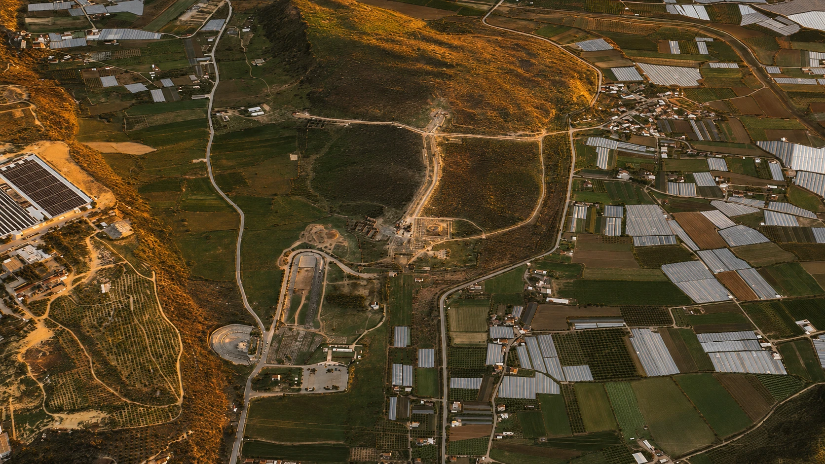
 AD 120–250Today
In today’s southern Türkiye, Antalya, there lies a ruin from ancient times. An ancient city called Perge, likely called the same or similar name in its time. The city is one of the best preserved ancient cities in the world. It is a city whose foundations were likely laid around 1500 BC, and persevered until its abandonment around 1100 CE. A 2600 year city, located in one of the most historically vibrant locations on Earth, must have went through a lot, I thought. During my research, I was proved right.
Surprisingly, not many people know Perge. So I wanted to prepare some documentation, to honour the beautiful ruins, and to give a small bit of information to the people who might visit it some day.
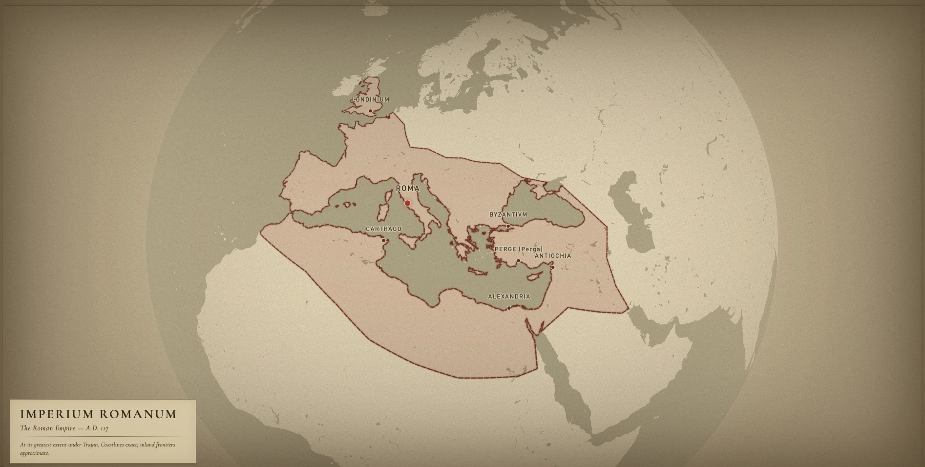
Location & Geography
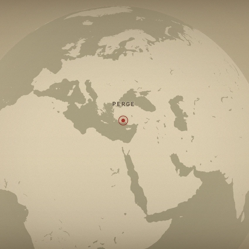
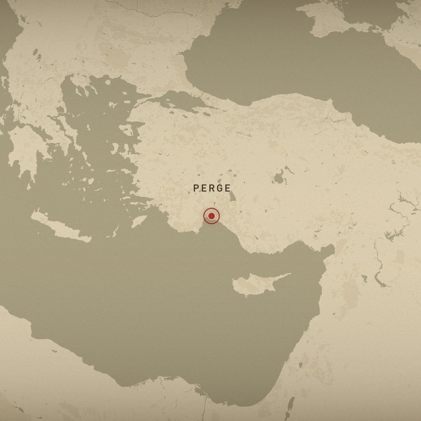
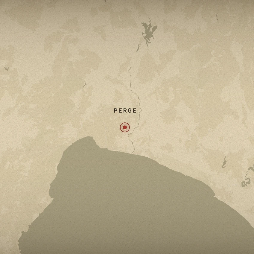
The city sits at southern Anatolia, around 14 kms away from the coastline of Antalya. Its location is prominent. Such a near location to the coastline would have proved valuable for trade from the Mediterranean Sea. Also, the surrounding geography of the city is host to Mediterranean climate, which means warm summers, mild winters, and most probably extensive natural resources for the living population.
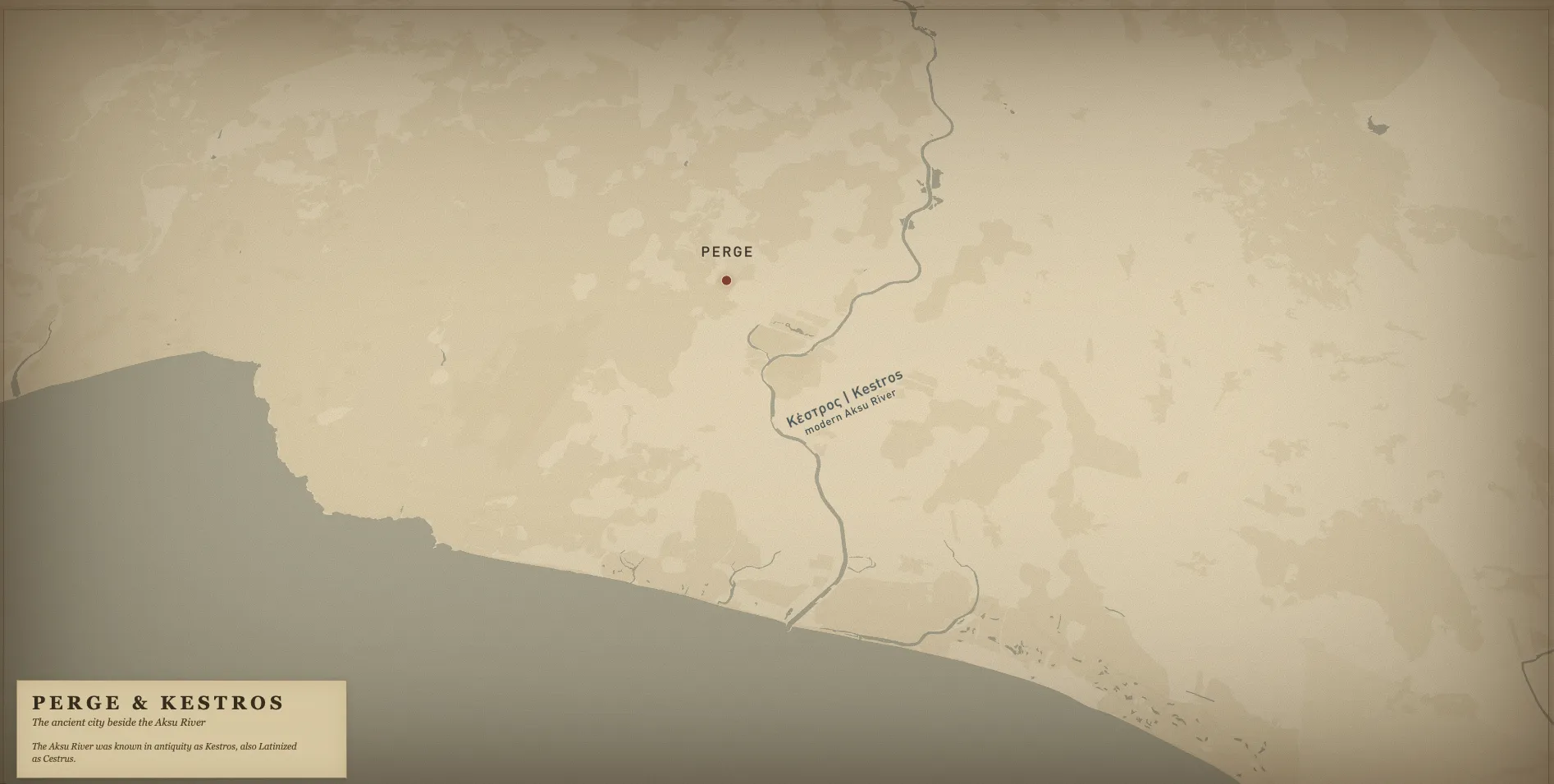
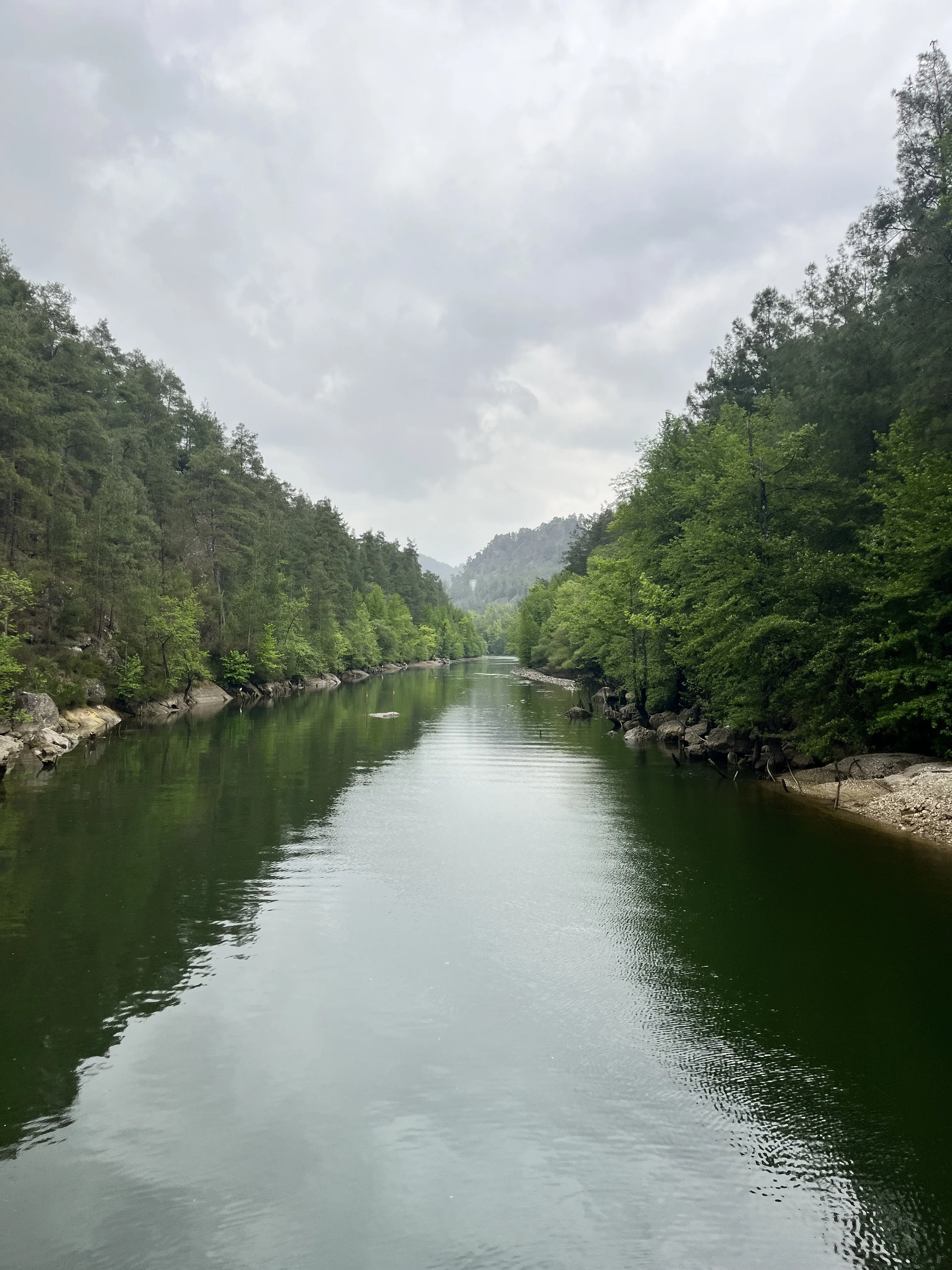
The River of Cestrus
The defining aspect of the city’s surrounding geography is the river of Aksu, then called the river of Cestrus. Perge noticeably was not built right next to the coastline. So to the locals, the river provided access to the Mediterranean Sea. Possibly small vessels, merchant ships, and fishing boats used the River of Cestrus as a passage to the sea. In addition, the fertile and strong river provided a stable source of fresh water to the city, supplying fountains, baths, water channels, farms alike.
As a Mediterranean city, Perge was more likely than not host to agricultural activities. Olives, grapes, figs, and grain alike required a strong source of fresh water to grow, which then Pergenians used for trade, and as their own food supply as well.
A city built right next to a coastline might seem advantageous for trade, but it also means the city is vulnerable to attacks from the sea. The fact that Perge was built inland, connected to the sea by a river, probably meant large warships could not enter through the small water passage. As a result, attacking the city via the sea route would have been impractical for attackers such as pirates or rival nations.
It appears that the River of Cestrus was the artery of Perge. From trade to security and food supplies, it played the essential part for the growth and preservation of the city for centuries.
History
Foundation: 1500–1200 BCE
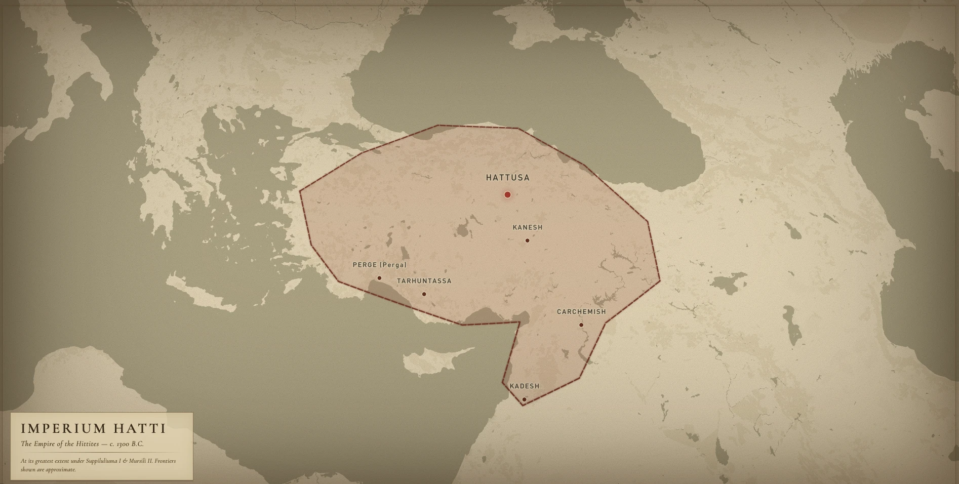
Perge was likely founded around 1500–1200 BCE. Although it is not known who laid the foundations, it is believed that it was an independent city, most likely populated by Anatolian’s of the time. It is said that Perge was under the Hittite Empire’s rule for around 300 years, between 1500 and 1200 BCE. This is no surprise, as the Hittite Empire was the strongest powerhouse of Anatolia at that time.
Hittite Empire Collapses: 1200–700 BCE
After the collapse of the Hittite Empire around 1200 BCE, the city likely remained independent, populated by native Anatolian’s called Pamphylians. Although this is a time where most of the Anatolian cities were abandoned due to a lack of a regional major power, Perge seems to have remained, which gives me the idea that the city was relatively secure and economically more vibrant.
Greek Colonization of Anatolia: 800–546 BCE
This is a time marked by the famous Ancient Greeks. archaeological evidence suggest that Perge became more “Greekified” during this period.
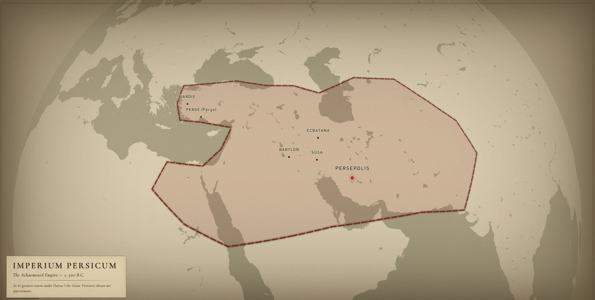
Persian Rule after the Battle of Thymbra: 546–333 BCE
Perge, which until that time was under the rule of various rising and falling Anatolian regional powers, accepted the rule of the famous Persian Empire, after the the Battle of Thymbra won by Cyrus the Great. To my knowledge, Persian Empire is not known for its cultural oppression, so the city must have remained relatively independent, and Persian cultural influence I think was mild.
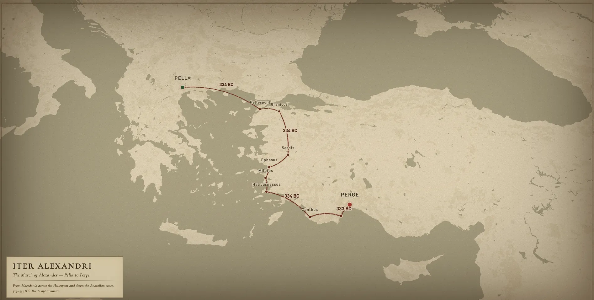
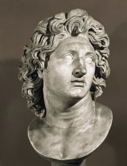
Rule of Alexander the Great: 333–323 BCE
To give you sense of historical scale, it is guessed that Alexander the Great entered this city in 333 BCE (after defeating the Persians in the battle of Granicus), almost 1000 years after the city itself was founded. So, from the eyes of Alexander the Great, he was entering to a city that was already 1000 years old.
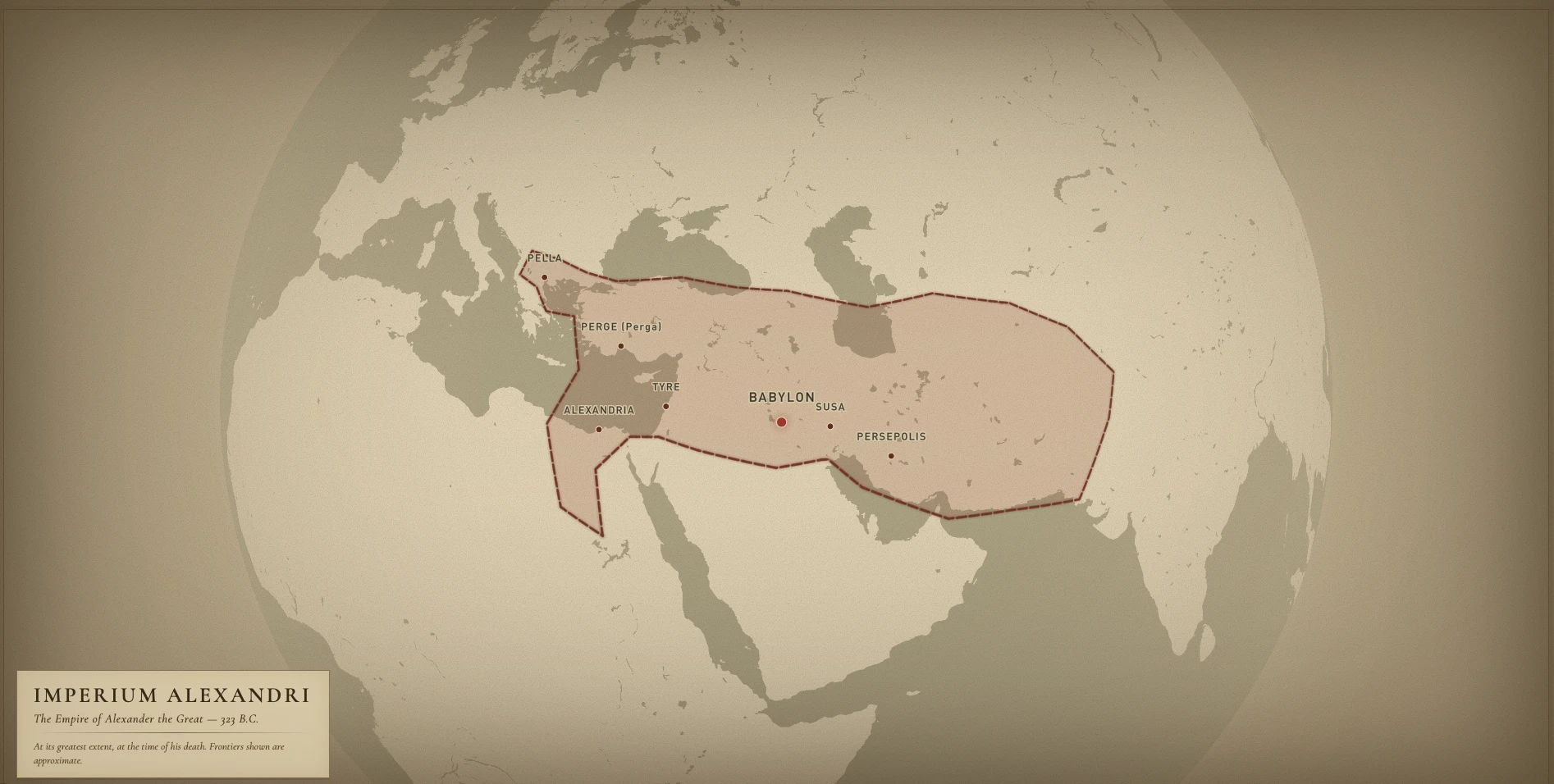
It is said that the locals of Perge welcomed Alexander, sending guides to meet him and guide him through the Taurus Mountains, towards Aspendos and Side.
To the locals of Perge, the time of Alexander must have been a time of rapid political change. After around 200 years of Persian rule, a Macedonian conqueror captures the control of the city, coming all the way from the European continent. Even more rapid was his rule, lasting only 11 years.
Time until the Roman Conquests: 323–133 BCE
After the death of Alexander the Great, his great empire starts to dissolve almost immediately. His generals start fighting for the rule of parts of the empire, and the city of Perge is left between these conflicts. During this time, I imagine Perge was living through a politically chaotic time. Armies passing through, faces on coins changing… But to my knowledge the city preserved due to its geographically key location, staying economically and culturally vibrant.
This period of roughly 150 years marks a time that is lacking a regional great power. It is a time of local conflicts and struggles, between the leftover kingdoms of Alexander the Great, and later between Anatolian regional powers.
Rome Arrives: 133 BCE–1100 CE
Roman (Byzantine) Empire control starts to weaken and dissolve 400 CE–1300 CE
This is a long, long period that witnesses the dissolve of both the Roman Empire, and
the city of Perge itself.
The Crisis of 7th-9th Centuries CE, The Arab Raids
Approximately, time between 600-800 CE is a time of hardship for the city of Perge. As the Roman control weakens, the rise of Islamic forces coming through the south creates a series of crises for trade. The Byzantine-Islamic wars results in an increase in taxation. The frequent Arab raids are the cherry on top. Needless to say, the city went through a troubled 100 years, which probably marked the beginning of the end of Perge.
Dissolution and abandonment: 700 CE - 1100 CE
For 400 years, the city lived through a gradual dissolution. Frequent conflicts between the Byzantine Empire, Arabs, and the Turks resulted in chaos and lack of economical stability. Although you could argue that such a rooted city would be able to stand these turmoils, the Aksu River, a component so vital to the city that the locals dedicated a river-god shrine to it, started to silt up and shift course. Perge’s arteries were cut.
In addition, Perge was not a city that had a harbour. A very near developing center, called Antalia, with a strong harbour and strong sea trade probably started to steal from the population of Perge. If we did a quick sped-up visual on the city during this time period, we would see columns slowly collapsing, decaying and broken states, a dissolving city.
The city I imagine, approaching towards the end of its lifetime, housed bandits, thieves or in other words the “excluded”. Until it got completely abandoned.
850 years later, an archaeologist starts excavations
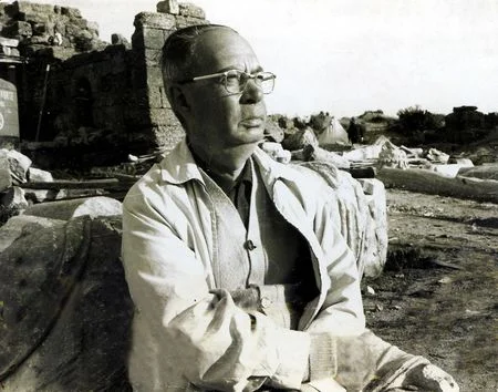
Due to the geographical location of the city, a sturdy ground, a mild earthquake region, the city never got lost. It was never buried in the ground or surrounded by hard forestation. So the locals always knew the city existed, but modern excavations came around 850 years later after the abandonment of the city. A Turkish archeologist named Arif Müfid Mansel started the excavations. The excavations continued for decades, continuing still.
Remains of Perge
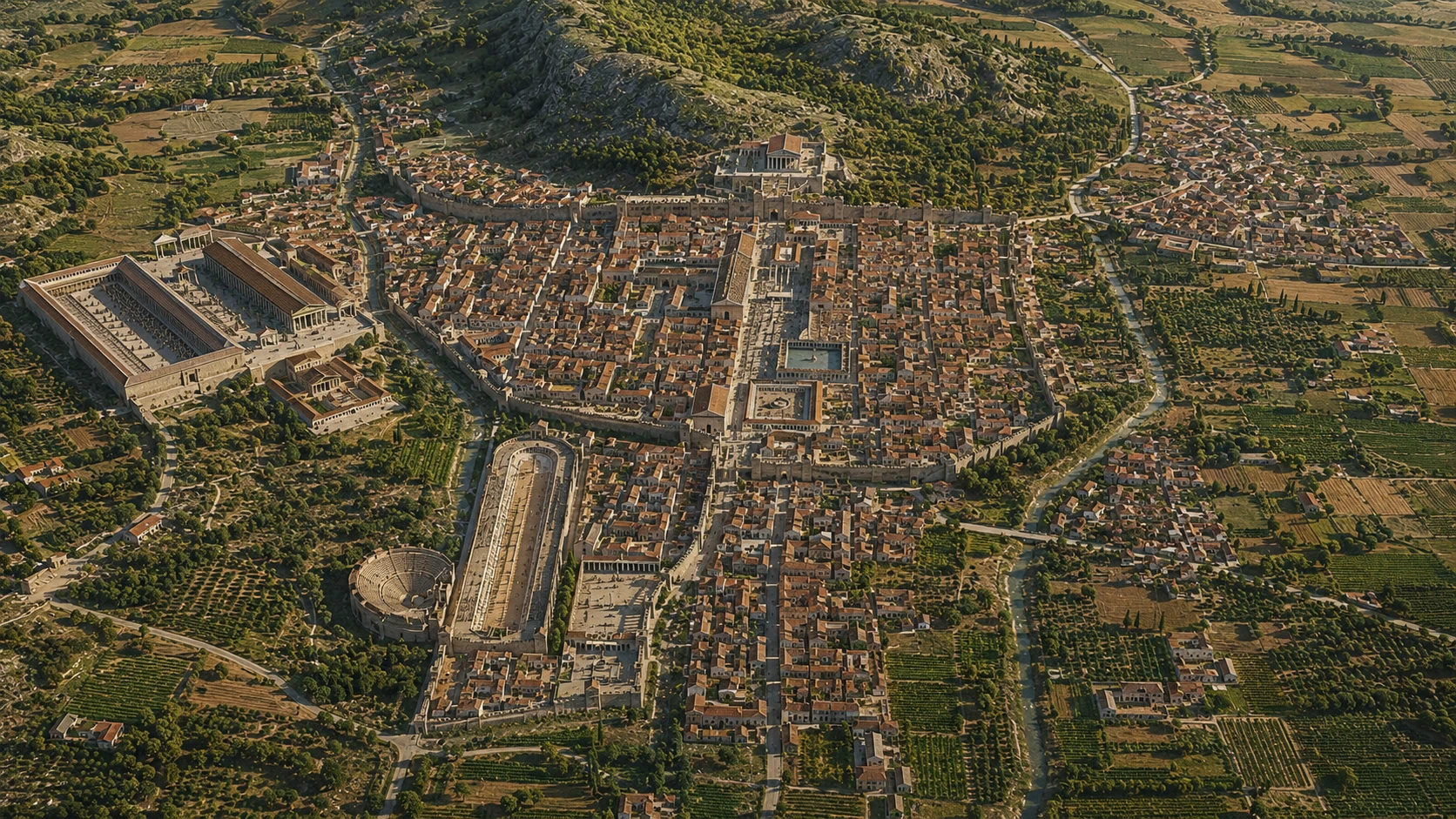
The Main Street
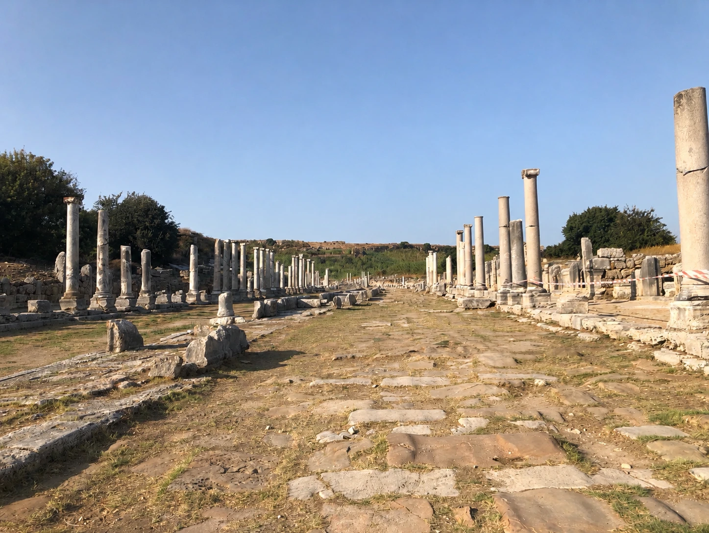
 AD 130–250Today
To this day, the remains of the main street of Perge feel intact. A large road with a waterway in the middle, separated into two ways, surrounded by columns and likely central buildings and statues of the time, was probably the main structure of the city.
The Statue of the River God Cestrus
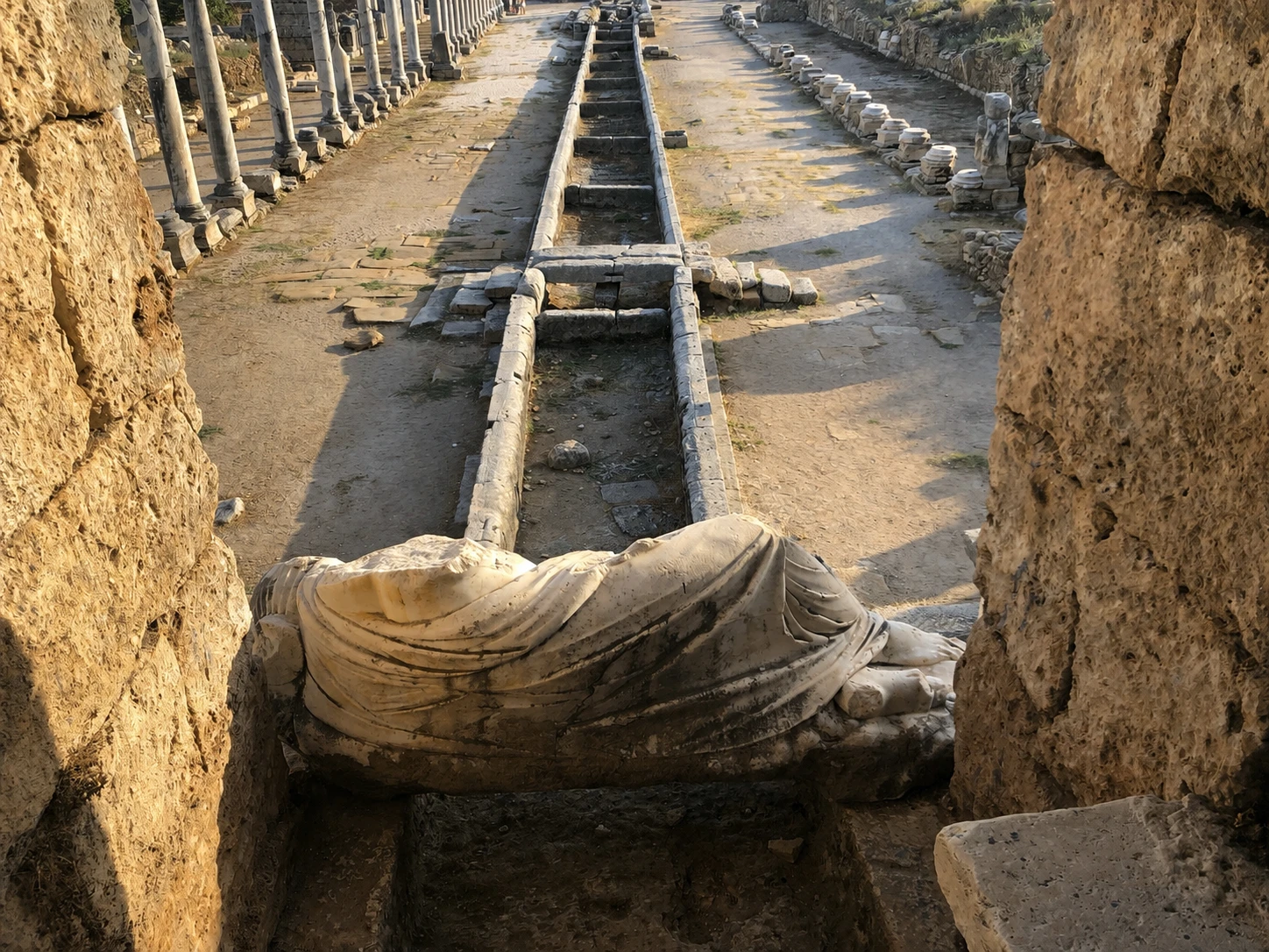
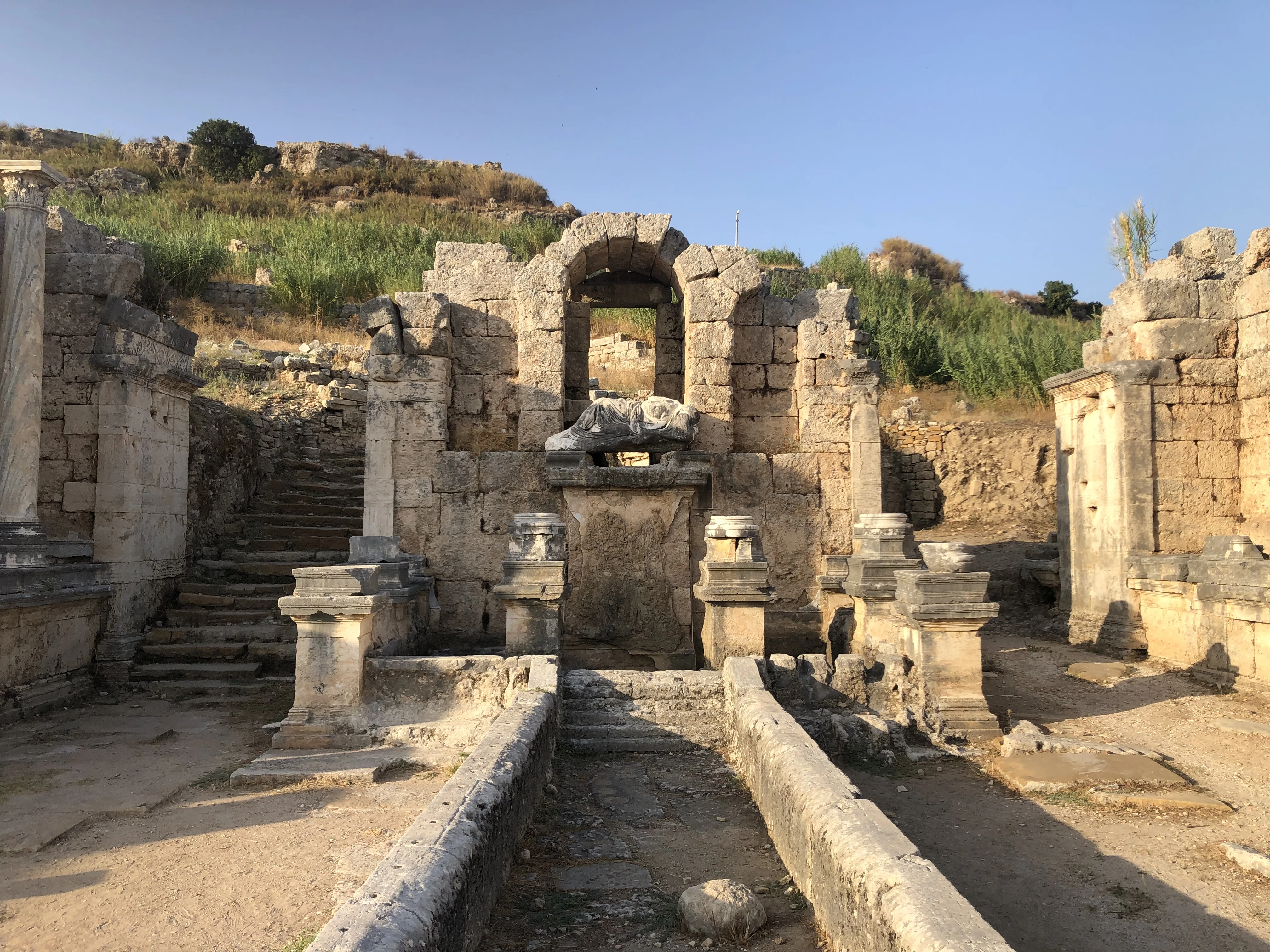
Perge was a river-city. The statue, placed at the end of the main street gives a strong signal as to how important the river (today’s Aksu River), was to the city. So much so, the locals dedicated a shrine/statue, which then would have looked glorious to the witnesses. The statue depicts a man, laying sideways, almost as if he owns the river itself. The statue personifies the fertile river, god of the river Cestrus.
The Cestrus River flew from under the statue, flowing from the shrine to fill the waterways in the main street. The locals likely used that water for their daily needs. A very symbolic even today.
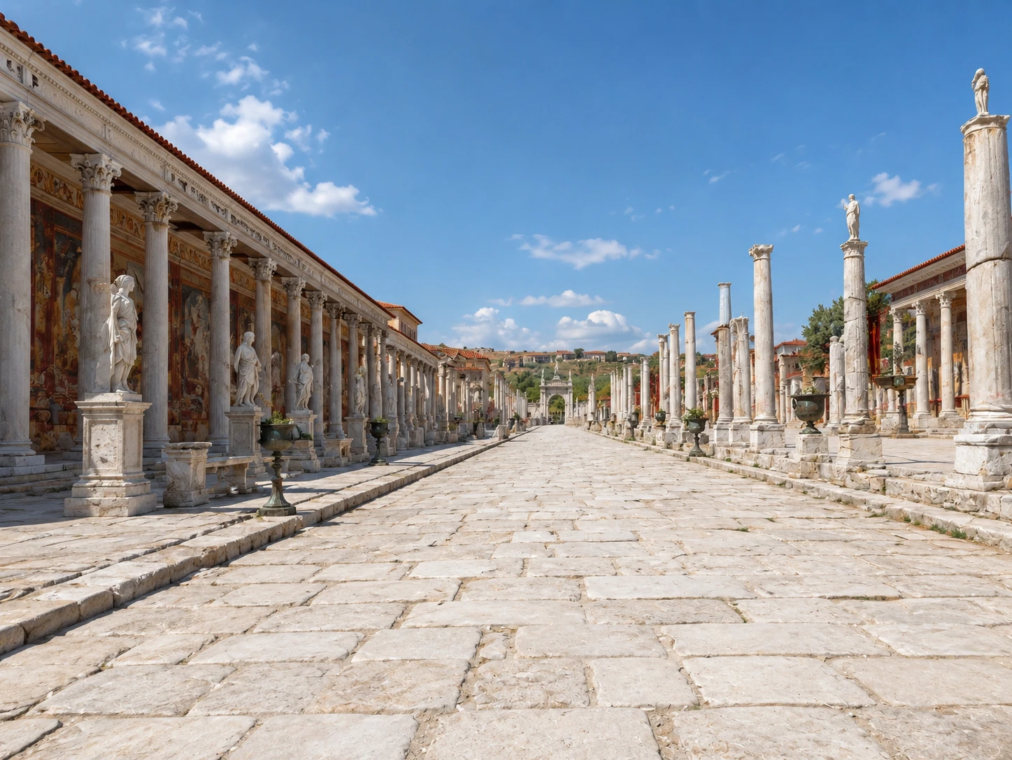
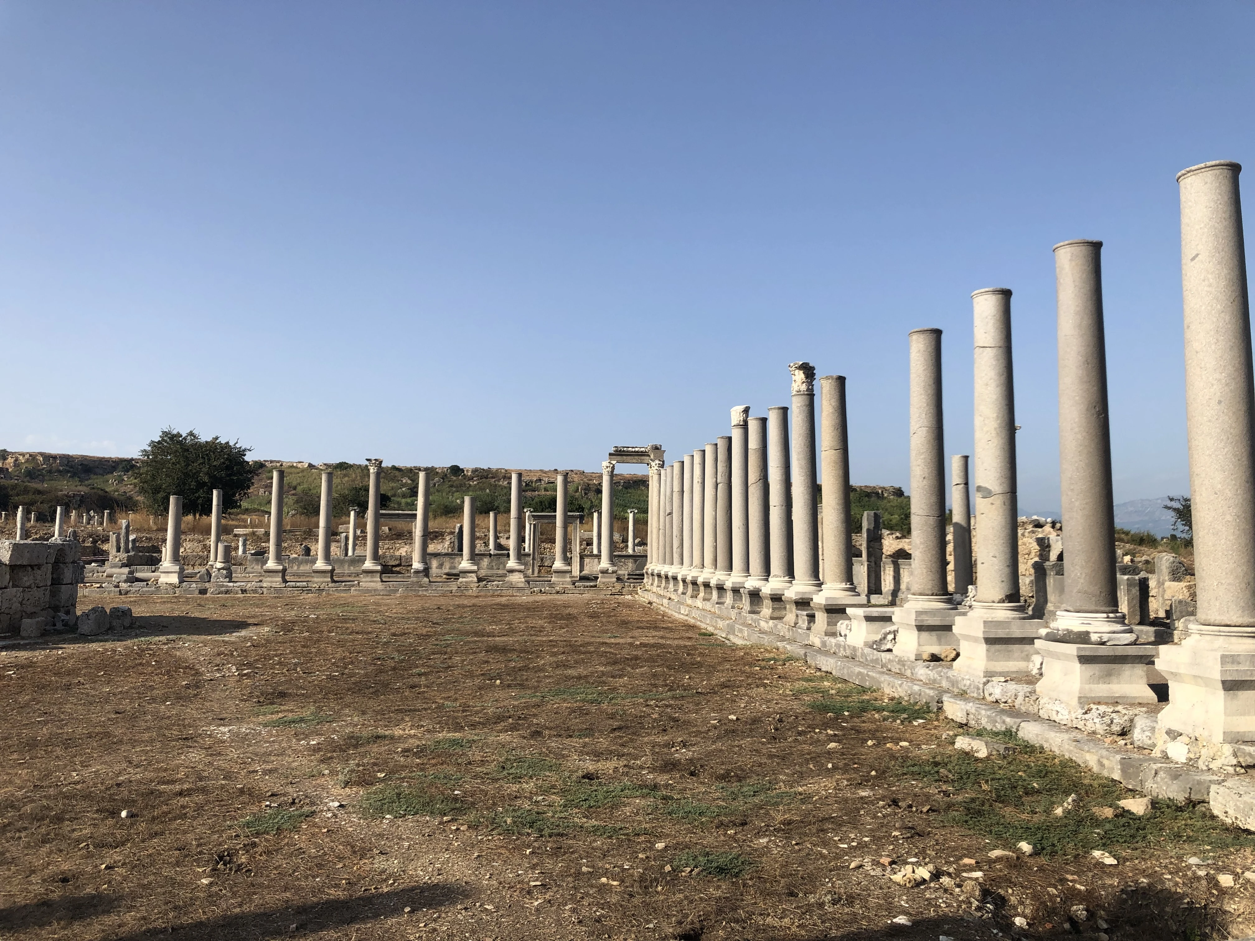
The Agora
 AD 130–250Today
The Agora, or the “marketplace”, was central to many Roman cities. It is a square structure, with columns towering on each side. Likely, behind the columns, there existed Roman-style buildings to cover the square-shaped area, to provide some insulation from the streets and give the traders a secluded space for trade. I imagine trade goods such as olives, grain, rugs, perfumes, clothing alike were bought and sold in this place.
Roman-era Marble Inscriptions
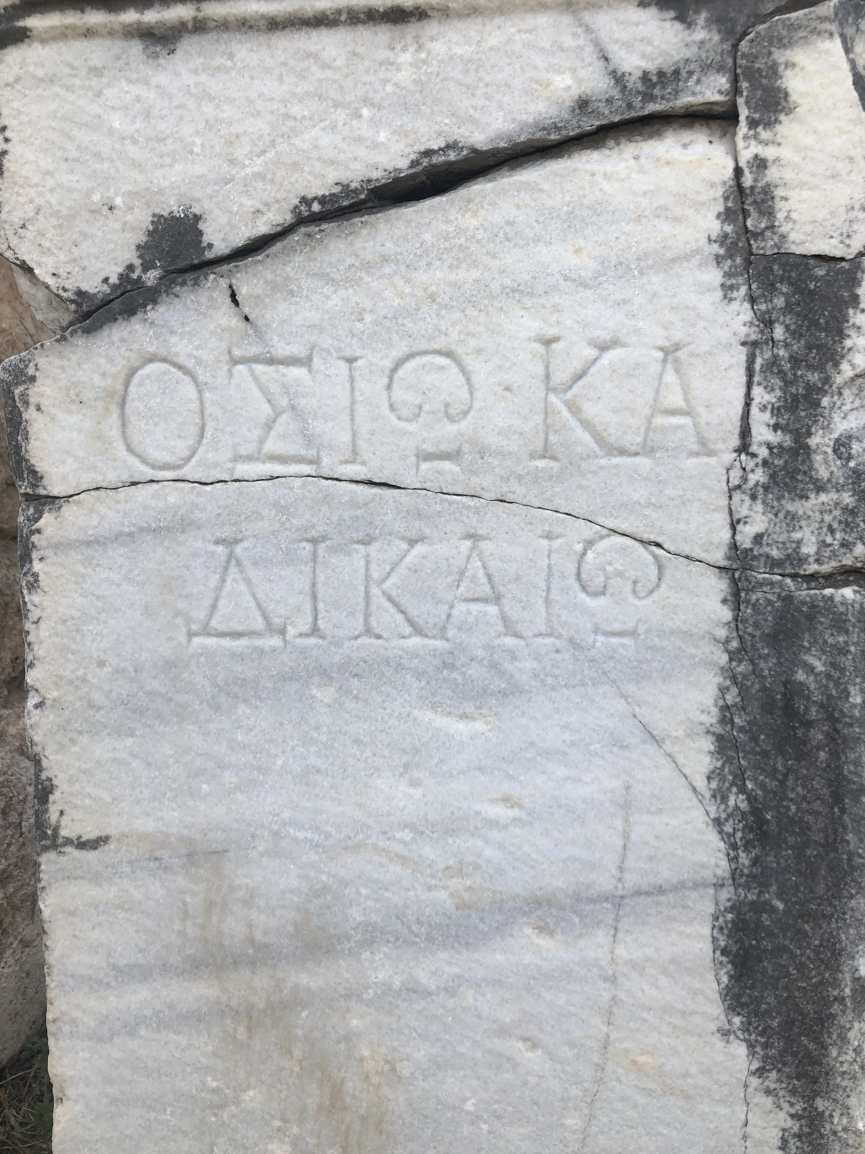
A marble stone, carved in the Roman rule era of Perge. The inscription reads “Osio Kai Dikaio”: “To the Holy and Just.”
A Roman Mosaic with Greek Culture
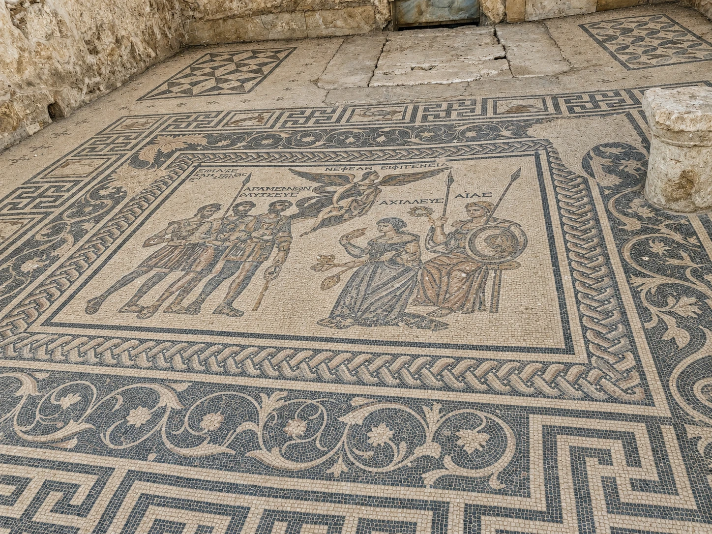
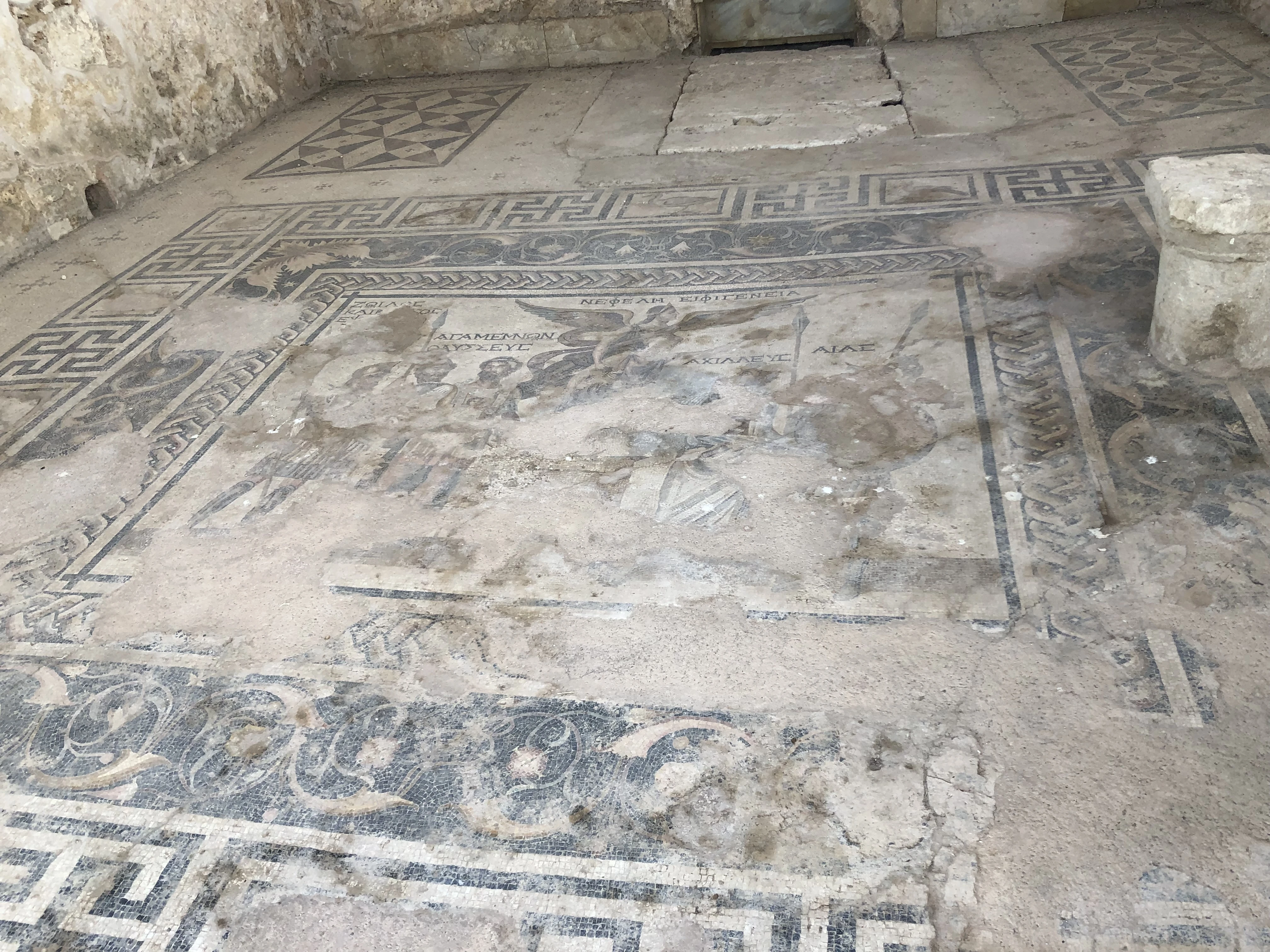 TodayAI Reconstruction for better visibility
This is one of the most well preserved pieces I have seen during my visit. It is a mosaic, depicting the Trojan War. We can see famous figures such as:
ΑΓΑΜΕΜΝΩΝ: Agamemnon, ΟΔΥΣΣΕΥΣ: Odysseus, ΑΧΙΛΛΕΥΣ: Achilles, ΑΙΑΣ: Ajax,
and one last figure, ΝΕΦΕΛΗ ΕΠΙΓΕΝΕΙΑ, whose translation to me at the moment remains a mystery.
The scene most likely represents the judgment or awarding of the arms of Achilles after his death in the Trojan War. In myth, Achilles’ armor became a prize contested mainly between Ajax and Odysseus. Odysseus ultimately won the dispute, which drove Ajax into madness and tragedy.
To Conclude
I hope you enjoyed this journey as much as I did. During my research and visit to this city, it was a hard realization for me that this city witnessed all. From the Hittite Empire of the Bronze Age, until the Byzantine collapse. To try to even imagine what the city lived through all those thousands of years would test the limit of anyone’s imagination. Yet still, there the ruins remain, an echo of a world history.